Streambank and lake shoreline vegetation in home landscapes can help protect water quality for fish habitats while also enhancing recreational boating, appealing views, and property value. Grass, flowering plants, shrubs, and trees that create a buffer of vegetation along the water hold soil in place, preventing erosion from floodwater and waves while also filtering pollution that runs off the landscape in stormwater.
These shoreline plants are known as riparian buffer vegetation. This resource explains how flooding and stormwater pollution affect waterways and how vegetation along the water reduces their negative impacts. It provides step-by-step planning, implementation, and maintenance of riparian buffer vegetation.
What is Riparian Vegetation and Why Does it Matter?
Natural streams, rivers, and lakes have plants growing right up to the water’s edge. This is called riparian vegetation, and it serves a critical role in keeping the banks from eroding. Riparian buffers are the zones along the water’s edge. Buffers protect waterways by providing a transition zone between upland development and surface waters. These buffers offer a variety of environmental, aesthetic, and economic benefits.
When stream flow is fast and high, or wave action batters a shoreline, banks and shores can rapidly erode. Eroding streambanks cut further into the soil of adjacent landscapes, widening the waterway and taking away land. These erosive water forces result in land loss for property owners. The eroded soils end up depositing in the body of water, resulting in muddy water and undesirable water quality.
Deposition of soil or sand, known as sedimentation, is the number one source of pollution for streams and rivers in north Georgia and the Piedmont region. High sedimentation impairs habitat for aquatic life and disrupts the ecological balance. Declines in stream health and water quality can translate into a decline in drinking water quality and recreational value of local waters. A vegetated riparian buffer with extensive soil-binding roots along the water’s edge can prevent erosion, land loss, and deterioration of stream, pond, and lake water quality.
As a homeowner and landowner, you can protect your property, community, and surrounding natural resources. Whether you have a quarter-acre lot or a large 40-acre lot, protecting your land and water resources on your property is the same.
How Flooding and Stormwater Pollution Affect Waterways
One of the best methods of defense against stormwater pollution and flood water damage along waterways is maintaining a buffer of natural land cover that includes a diverse mix of herbaceous and woody plants. The following descriptions are examples of damage incurred by excess stormwater and flooding along water bodies.
- Extra stormwater from recently cleared or impervious landscapes, such as lawns, rooftops, and pavement, contributes to flooding downstream during heavy rainfall events. This flooding damages streambanks, shorelines, and any structures in affected floodplains. This results in property damage and land loss and can endanger lives downstream during catastrophic flood events.
- Flooding causes eroding streambanks to cut further into the soil of adjacent landscapes, widening the waterway and taking away land. The eroded soil ends up depositing in the waterbody. This results in muddy water and undesirable water quality.
- Fertilizer, pesticides, trash, and pet waste run off of land during heavy rains, causing stormwater pollution. This overloads water with nitrogen and phosphorus that cause algae blooms. When the algae die and decompose on the bottom of the lake or pond, associated bacterial activity uses up oxygen from the water that is vital to fish and other organisms in the system.
- Oil, tire material, and other automobile fluids can accumulate on local roads and driveways, and then wash into streams with stormwater. This pollution directly impacts aquatic animal health and disrupts fish and wildlife food chains.
- Flood water covering land can damage landscape plants and contaminate well water supplies if wellheads are inundated.
Purpose and Function of Riparian Buffers
Whether we live near a stormwater drainage ditch, pond or lake, or natural river or stream, our actions affect local water quality. This is important to consider, as our local waters are the source of clean drinking water and provide recreational opportunities.
As residential development increases in rural areas of north Georgia, resulting landscape disturbances and water consumption increase pressure on our water resources. It is projected that an additional half a million people will be living in the Piedmont and mountain regions of Georgia by the year 2030. The resulting land use changes in north Georgia watersheds can negatively affect the quality of drinking water supplies and recreational waters for residents.
Pollution from runoff, lawns, and roadways increases with more land clearing and development. After new homes are constructed and sold, it is the property owner’s responsibility to maintain the landscapes in these watersheds.
There are state regulations that protect riparian land, and some county and city departments may have their own conservation ordinances that are at least as protective of the resources. These regulatory agencies review projects with large disturbances in riparian buffers to prevent pollution and erosion problems. State natural resource agencies, conservation districts, and educational institutions work to educate and raise awareness of stream and lake water quality by promoting riparian buffers as a conservation practice in sensitive watersheds.
Riparian vegetation provides the following benefits to landowners and our water resources:
- Money savings: Vegetated buffers cost less to maintain than turf, and native vegetation has the additional advantage of reduced use of fertilizers, pesticides, and irrigation. Buffers can also allow for decreased public investment in storm water management and water quality remediation by reducing flooding, erosion, and sedimentation. Desirable water features can also increase a property’s value in the real estate market.
- Mental and physical health improvement: It is proven that nature in general reduces stress and can improve healing and recovery times. Outdoor activities may be more enjoyable beneath shade trees, with more opportunities for recreational activities such as bird watching.
- Sense of place and privacy: A homeowner can plan a landscape to frame desirable views, screen unwanted views, and enhance what others see from the water. Dense vegetation also reduces noise pollution from neighbors or boat activity.
- Reduction in flooding and flood damage: Vegetated buffers reduce downstream flooding by slowing stormwater velocity, storing water in soil, and providing space for stream floodwaters to overflow banks. Maintaining vegetated riparian buffers also reduces flood damage by locating buildings and development away from flood plains. Site-specific flood risks depend on storm severity, flood plain width, and riparian buffer width. The wider the vegetated buffer, the better the protection from floods. Staying out of the floodplain completely may require buffers hundreds of feet wide.
- Reduction in erosion: The deep entangling root systems of trees and shrubs absorb stormwater runoff and stabilize shoreline soil to reduce erosion along the banks of waterways. Stabilizing stream banks with heavy rocks may keep soil in place under moderate storm flow, but unlike vegetative cover, it does not absorb water to prevent downstream flooding.
- Natural habitat: Many wildlife species either live in riparian areas or use them as travel corridors. Wider buffers that run continuously alongside the water’s edge support more species and are very effective in protecting amphibians, birds, and fish spawning and nursery areas.
- Reduction in heating of waterways: Stormwater runoff heated by sunlight and warm road asphalt can raise the temperature of receiving water bodies, which can impair the aquatic environment and disrupt native fish ecology. Trees in a riparian buffer slow and cool the runoff and shade the ground and water, reducing further heating.
- Reduction in stormwater pollution: Buffer vegetation captures sediment and other harmful chemicals in runoff, such as excess nitrogen and phosphorus from fertilizers, which are primary pollutants to waterways. Thick grasses, trees, and shrubs slow stormwater runoff, absorb some pollutants, and allow sediments to settle out before reaching a waterway. Riparian buffers at least 30 ft wide with less than 10% slope can remove 74% of nitrogen, 79% of phosphorus, and 84% of sediment in runoff (Wenger, 1999).
Landscapes along lake shores, stream banks, and the edges of rivers are constantly affected by land use upstream. If a landscape upstream contributes to excessive stormwater flow, it can damage property downstream. Understandably, how landscapes and buffers are maintained upstream is outside of the downstream property owner’s control. However, there are landscaping methods that can help reduce waves and stormwater flood damage to your property.
Creating and Maintaining Riparian Buffers
The steps to create, enhance, and maintain a natural vegetative buffer between your home or lawn and a waterway include site assessment, planning, implementation, and maintenance. These steps are described below and can be applied to parcels of various sizes.
Site Assessment
A site assessment of the riparian buffer area should be done first to determine shoreline or stream bank stability, soil erosion, and existing plant community conditions. The existing dimensions and space for additional riparian buffer width should also be noted. If the shoreline is severely eroded to steep walls, a wider riparian buffer may be necessary to accommodate the inevitable erosion and bank collapse (Figure 1).
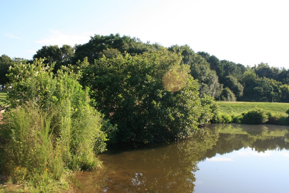
Shorelines maintained as turfgrass up to the water’s edge, without diverse mixes of tall grasses, shrubs, and trees, will likely suffer erosion problems and land loss (Figure 2).
If nearby structures, such as sheds, decks, or house foundations, are in danger of being damaged by further erosion, then a larger restoration and land grading project might be necessary. This would require levels of permitting from state or federal regulatory agencies because of potential erosion concerns during the restoration project. Accepting some natural erosion in a stream channel and allowing for a greater riparian buffer width will be less costly than large-scale restoration efforts involving changes in slope gradation. Given time, stream channel banks can recover to become gently sloped banks, but with widened stream beds (Hawley et al., 2020).
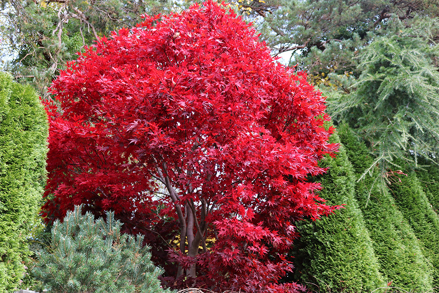
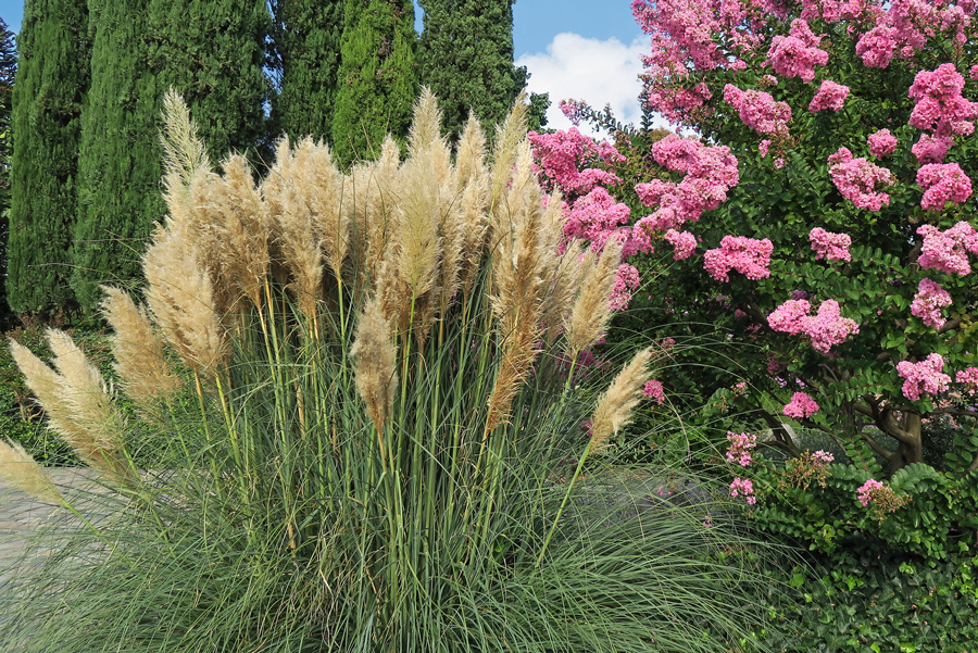
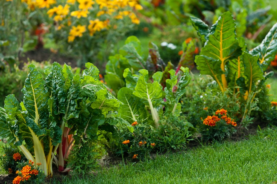
When assessing the site conditions, take note of any desirable plant species. It is ideal to keep selected plants that are naturally found in your region. It can save you the cost of plant material, and the existing native plants are already naturally adapted to the site (Figure 3).
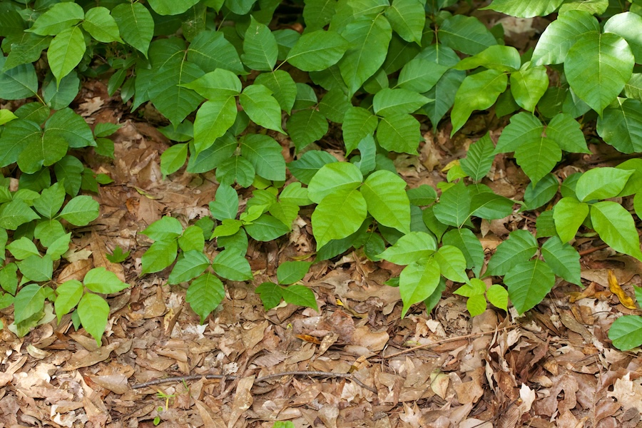
Consider removal of any invasive, non-native, and noxious plants (for more information on invasive plants and removal strategies, see “Further Resources” at the end of this resource). Invasive plants can aggressively smother and kill the beneficial native plants that better protect soil stability and support birds and pollinators. An eradication effort for aggressive and invasive plants should be included in your planning. Invasive species removal and prevention are long-term activities, and it might not be possible to remove them completely in the first year. Success may require 5 years or more for complete removal efforts; prevention of invasive encroachment is an indefinite effort.
During an assessment, begin thinking about how much visibility or privacy you need the buffer vegetation to provide. The buffer will ideally contain a mix of deciduous and evergreen plants, as well as tall, medium, and small trees, shrubs, flowering plants, grasses and sedges, and ground covers. Snags and dead trees can be beneficial as nesting sites and refuge for wildlife. If snags and dead trees do not threaten structures, driveways, utilities, or public safety, consider leaving them in place.
Planning the Layout
When designing the shape and size of a vegetated riparian buffer, consider available space, flood potential, erosion, water quality, scenic view, and recreation access. A riparian buffer’s effectiveness in withstanding flood and erosion damage and protecting stream or lake water quality depends on buffer width, land slope, soil quality, vegetation conditions, stormwater, and flood plain elevations. Steep slopes, highly erodible soils, and sparsely vegetated buffers will require greater buffer widths for more effective erosion control.
Even if your property is small or you desire a lawn for recreational uses, designating as much space as possible for a vegetated riparian buffer can still help preserve water quality. For new land-disturbing projects, the state of Georgia requires at least a 25-ft buffer from the edges of streams or lakes and 50-ft buffers on designated trout fish habitats unless a variance is approved. Some landscaping and maintenance that results in minor soil erosion may qualify as a minor land-disturbing activity and does not require a buffer variance permit (Environmental Protection Division, 2011).
Recommendations included in this publication are for naturalized riparian buffer areas and are meant to reduce efforts in maintaining a manicured landscape area. Your current riparian buffer may be lacking vegetation and need additional plantings. Plant selections can be custom-tailored to design a buffer that is functional and appealing. Selecting low-growing plants or trimming certain tree branches allows you to frame desirable views of the water from specific vantage points (Figures 4 and 5).
Maintain existing naturalized vegetation to frame or improve your view of the water by pruning medium-sized understory shrubs or removing a few tree limbs. If the goal is to screen unwanted views and reduce boat traffic noise along the buffer, larger evergreens or densely planted trees may be preferred (Figure 6).
The view of the buffer area will look different from inside your house compared to standing on your lawn. If you are on a lake or community pond, you may not want your entire house and yard visible to others from the water. Consider placement of tall trees, shrubs, or perennial grasses and wildflowers to shape the view or maintain privacy. Diverse heights of vegetation, from tall trees to grasses and wildflowers, will provide effective shoreline stabilization and be aesthetically pleasing.

Image: Created in BioRender by T. Deeb, 2025 (https://BioRender.com/jeguekl).
Figure 7 depicts a conservation riparian buffer design with diverse types of vegetation. Ultimately, the location and presence of trees, shrubs, and grasses can be adjusted to your preference if the functionality of the riparian zone is meeting its objectives by slowing surface runoff, holding soil, maintaining or improving aquatic habitat, and meeting your specific needs. An example of this would be keeping shade trees to preserve water ecology while using the tree to hang a hammock.
Zone 1, the area most vulnerable to erosion and flooding, should be planted with native species that can tolerate frequent inundation. As you move from the water’s edge toward the upland areas of the property, soil moisture will gradually shift from wet to dry, influencing the types of plants suitable for each zone.
Zones 1 and 2 benefit from the presence of trees and shrubs, which help intercept polluted stormwater and groundwater. Their root systems play a key role in stabilizing the soil and reducing erosion during storms and floods.
Zone 3 marks the transition from the riparian buffer to the upland areas. This zone acts as a first line of defense, supporting the effectiveness of Zones 1 and 2. In agricultural landscapes, Zone 3 typically includes herbaceous plants or grasses, while in residential settings, it may feature a mix of ground covers, shrubs, and tall canopy trees.
Depending on the size of the property, these zones may need to be adjusted, condensed, or combined, which will influence planting choices and maintenance strategies.
Existing vegetation cover, sunlight/shade conditions, shoreline steepness, soil type (sand, silt, clay), ambient soil moisture, and potential flood reach in the riparian buffer will help guide your planning. Your planning effort will benefit from first identifying existing plant species on-site to better understand natural growth characteristics.
Adding new plants will require an understanding of the soil and its drainage conditions. If planting on the upper slope of the riparian buffer, or furthest location from the water, selected plants should be able to withstand moderate drought conditions. Steep stream banks and lake shorelines may not be suitable for towering canopy trees that would be more stable further back from potential erosion spots. Areas prone to flood inundation may require certain wet-tolerant species. Perennial grasses or shrubs have strong root systems and less branch surface area, which will allow them to perform better in high-velocity flood zones than small trees.
Instead of maintaining a shoreline completely cleared of vegetation for your access to the water, keep only a narrow access path to reach fishing, swimming, and boating activities.

Vegetated or mulched footpaths through the riparian buffer are acceptable for accessing a dock or beach if they are designed with angles and switchbacks toward the water. Zig-zagging your pathway will minimize erosion damage from stormwater as it travels down the path and spreads out into the buffer. Water bars can also divert stormwater away from the path (Figure 8) or timber-framed earthen steps can be used to prevent erosion and gully formation (Figure 9).

Environmental Regulations and Permits
Depending on the scope of your shoreline restoration project, you may need a permit from the Georgia Environmental Protection Division (EPD) or your local issuing authority (LIA), such as the planning, conservation, or water resources department. Cities or counties that meet certain population thresholds are designated as LIAs. A full list of these authorities is available through the Georgia Soil and Water Conservation Commission.
In Georgia, land disturbances are regulated within a 25-ft buffer from the shoreline of perennial streams or lakes and a 50-ft buffer for waters designated as trout habitat (the Georgia Environmental Protection Division maintains a list of designated trout stream habitats; see the Resources and References section at the end of this article).
In general, larger projects that involve significant soil disturbance are more likely to require permits. For example, steep, eroded shorelines that need heavy machinery for slope regrading must undergo review and approval from the appropriate permitting agency because of the increased risk of sediment pollution from excavation. Any construction of structures such as retaining walls, revetments, docks, rock banks, or similar hardscape features will also require permits.
Smaller restoration efforts, such as maintaining existing vegetation or adding a few native plants, may not require permit review. However, projects involving soil excavation and extensive planting often require a land disturbance permit (LDP) from your local LIA. It’s best to consult with your local water resources, planning, or conservation department to determine what is needed.
Permit requirements are assessed on a case-by-case basis. If your local government is not an LIA, an LDP may not be required, but a buffer variance from the Georgia EPD could still be necessary if the project poses significant erosion risks.
For larger-scale projects under the jurisdiction of the U.S. Army Corps of Engineers or the U.S. Fish and Wildlife Service, additional federal permits may be required. You may also need to notify other entities, such as homeowners associations, Georgia Power (for shoreline projects on their reservoirs), or the Historic Preservation Division of the Georgia Department of Community Affairs.
To confirm all requirements, check with your local government and your regional EPD office to determine the applicable jurisdictions for your project.
Plant Selection
It is important to put the right plant in the right place by adhering to plants’ specific needs for shade, sun, moisture, and soil quality. Choose plants that are compatible with hardiness zones in your region, erring on the side of the potential for colder weather. Hardiness zones are based on your area’s lowest average winter temperature, but extreme winter temperatures can last long enough to affect plants that favor the warmer end of your hardiness zone. If you choose plants for zones higher in number than your zone, they are likely to die during frigid winter temperatures.
Table 1 provides a list of recommended native plants, including herbaceous plants, shrubs, and trees.
Strive for diversity with a mix of native trees, shrubs, ground covers, and grasses (Figure 10). Select plants that flower and bear fruit at different times of the year for visual aesthetics and for bird, pollinator, and beneficial insect habitat.


If you choose non-native ornamental nursery plants for the buffer zones, be sure they are not invasive, do not aggressively spread across your landscape, and do not smother desirable plants. Also consider that planting ornamentals in the buffer area might not provide the best view of such aesthetically pleasing specimens.
Implementation
Slower-growing plants may take longer to fill empty spaces, but they will require less maintenance, and most will last longer because they are more resistant to damage from storms. Large patches of unplanted ground increase the amount of sediment washed into the receiving water body. Dense plantings provide better stormwater filtration and decrease soil erosion. However, you will need enough space between plants to allow each to reach its full spread at maturity. Use mulch initially to cover bare soil around small and sparse plantings, then let natural leaf litter and ground cover fill in over time.
There is a higher probability of survival when planting trees, shrubs, young grasses, sedges, and flowering perennials in mid- to late fall. Cooler temperature conditions reduce overall heat and drought stress, which is beneficial to newly planted plants. Planting in the spring is an option, but more attention to watering is needed in warmer and drier months.
For annual flowers and other native meadow mixes, the best time to plant seed is in late winter to early spring. Be sure to check with your seed provider on the timing specific to the mix ordered.
Sourcing Plants
Native plants can be purchased from nurseries, native plant societies, Master Gardener plant sales, and garden clubs. Your local Extension office can provide a list of nursery suppliers that carry natives. The Georgia Native Plant Society has statewide chapters that hold plant sales in the spring and/or fall. The State Botanical Garden of Georgia is an excellent source for information on plant culture; it also offers plant sales twice a year.
Explore native plant species availability and plan accordingly before starting your buffer project. The Georgia Native Plant Society is a reliable source for learning about plants local to your area. Propagation or relocation of nearby natives is an option when sourcing material. Many woody plants can be easily propagated by taking stem cuttings. Most grasses, sedges, and ferns can be divided for replanting in your project site, and seeds can be collected from forbs.
Before purchasing plants, be sure to check with any regulatory entity your property may fall under. This may include, but is not limited to, the Army Corps of Engineers, homeowners associations, or your city or county. There may be restrictions on what species are allowed and how close to the shoreline they can be planted.
When it comes to installation, larger plant material is often better. Larger plants have a better chance at outcompeting the existing vegetation on-site, reducing the need for irrigation water, and are also less likely to be trampled (Figure 11).

It is important to install tree cages around newly planted saplings until they are mature enough to survive deer browsing on leaves (Figure 12).

If your budget is small, other options for starter material can be explored. For example, live stakes reintroduce plants directly into the stream bank (Figure 13). Live stakes are a low-cost option and something that you can do easily on your own property. Stem cuttings taken from trees during their dormant season (before the buds break in the spring) are inserted directly into stream banks.
These cuttings, referred to as “live stakes,” will eventually grow into new shrubs or trees and are an effective way to establish roots in the stream banks and help prevent further soil loss. Cuttings also can be rooted prior to planting in the spring (Figure 14).

For live-stake planting in Georgia streams, the best tree species primarily are black willow, silky dogwood, and elderberry, as they are native to our area and readily root from cuttings.
The buffer, or vegetated corridor, can be phased in over time. Planting everything at once puts large areas of soil at risk of erosion. It is important to minimize soil disturbance during restoration to prevent erosion problems and pollution in the waterway. This is particularly important when planting potted or live stake plants in the buffer with large areas of exposed soil for prolonged periods.
Maintenance
Riparian buffers are meant to reduce your maintenance efforts. Native plants naturally colonizing the buffer will reach full growth potential without any landscaping inputs or maintenance if they are protected from aggressive invasive plants. When adding additional plants appropriate to the region, you can assume that the plants will also reach their full size for the site conditions without any kind of pruning.
One goal for the vegetated riparian buffer is to reduce the need for manicured lawn and landscape maintenance as much as possible. Ideally, no pesticide or fertilizer applications and no mowing or mechanical trimming would be needed. However, encouraging and protecting existing native vegetation in the buffer will require initial and periodic long-term maintenance.
In the first 3 to 5 years of riparian zone planting and maintenance, allow for new plantings to establish themselves and fill in the growing space. If the plants selected for the space were small when introduced, you may need to intensively manage the open space around them during this initial time by trimming shrubs or grasses that compete with the new plants. As the plants grow to fill in space, the amount of annual maintenance they require will be reduced.
Beyond 5 years of acclimatization and encouragement, the riparian buffer site should be monitored annually for erosion, invasive plants, and the health of desirable vegetation. Erosion stabilization, replacement plants, and invasive plant eradication might be necessary if the associated problems are evident.
Regular maintenance is required for the first 3 to 5 years of buffer installation, particularly where invasive non-native plant species removal is necessary. Desirable plants must compete with invasive plants in buffer zones, and selective control of invasive plants is key to maintaining buffers. The seeds of invasive plants are easily introduced to the buffer by moving water and wildlife, and ongoing prevention of their establishment will be necessary. Preventing invasive plant colonization by pulling or cutting sprouts may be required every year for very aggressive species, such as Chinese privet, tallow, kudzu, wisteria, and Bradford pear.
Physical or mechanical removal of smaller invasive plants is the best practice when working near water bodies. It is easier to remove the plants when they are younger. Continuous cutting of older invasive plants will also help weaken them and stop their growth, allowing for easier removal by pulling, digging out, or pesticide application. Basal spray applications of pesticides such as triclopyr work well on brush and invasive trees. Grass-specific herbicides or preemergent herbicides can help in some situations as well. Glyphosate is also a great option because of its lack of soil activity. This allows you to target certain plants or to treat an area while also maintaining the ability to immediately replant once the competition is gone.
For larger diameter woody invasive trees, a “cut-and-paint” technique with glyphosate will be needed to prevent sprouts from the cut trunk. For chemical and pesticide use near waterways, care should be taken to avoid excess dispersion or spills in the buffer area. Always consult the product label or contact your local Extension agent for additional guidance.
Aside from invasive plants, damage from wildlife can challenge new plantings. Utilizing cages or tree tubes for 2 or 3 years can prevent browsing defoliation and allow the plant roots to become established. Remove the cages when the plant has the strength to heal and regrow following damage. Techniques such as using putrid egg solids reduce wildlife pressure in subsequent years. Alternatively, temporary fencing or electric fence wiring can be used to deter deer activity around new plantings in larger areas.
Once the new plants are well-established, there will be little or no maintenance required. However, if you are maintaining an area for a scenic view of the water, you may need to selectively prune a few branches from trees or shrubs. If woody vegetation and shrub cover consistently exceed the desired size, consider planting a different species as a replacement. For most grasses, it might be appropriate to mow annually to maintain grassland habitat sections of your buffer, typically in zone 3 (refer to Figure 7).
You will need to mow several times during the first year to control weeds. Mow often enough to prevent weeds from growing taller than 8 in. or developing seed heads. At the end of the growing season, discontinue mowing to leave plant material as overwinter protection. In the second spring, mow leftover winter vegetation to the ground before the start of the growing season. From the second year on, mow your meadow annually, late in winter or early in spring, before the next year’s growth begins. This will help prevent invasive shrubs and woody tree saplings from establishing, protecting the desired perennial meadow grasses, herbs, and flowers.
This resource is provided as a service by University of Georgia Extension to help homeowners with decision-making for plant choices and management strategies on private property adjacent to streams, ponds, and lakes. For further information on a variety of related topics, contact your local county Extension office and explore the resources below.
Table 1. Recommended Native Plants.
Search or browse this section for detailed information on native herbaceous flowers (forbs), grasses, sedges, vines, shrubs, and trees recommended for planting along stream banks in North Georgia.

Scroll for more
Legend
Resources and References
Altman, K., & Jackson, K. (2021). Stream bank repair manual for South Carolina. Clemson University Cooperative Extension Service. https://dc.statelibrary.sc.gov/entities/publication/3a65686c-1f5c-4ec2-84e9-e69b38ba162e
Chatham County – Savannah Metropolitan Planning Commission. Riparian buffers in your backyard for Chatham County and the Georgia coast. https://www.thempc.org/docs/lit/NatResc/BMP/BMP_Riparian-Buffers.pdf
Daly, T., & Delaplane, K. S. (2022). Pesticide safety for the homeowner (Publication No. C 998). University of Georgia Cooperative Extension. https://fieldreport.caes.uga.edu/publications/C998/
Deeb, T. (2025). Buffer Zones- No Text. Created in BioRender. https://BioRender.com/jeguekl
Department of Watershed Management. (2014). City of Atlanta riparian buffer revegetation guidelines. City of Atlanta. https://www.atlantawatershed.org/wp-content/uploads/2020/09/City-of-Atlanta-Riparian-Buffer-Revegetation-Guidelines-101514.pdf
Environmental Protection Division. (2011). Streambank and shoreline stabilization. Georgia Department of Natural Resources. https://epd.georgia.gov/sites/epd.georgia.gov/files/related_files/site_page/Streambank_and_Shoreline_Stabilization_Guidance_Book_Revised_April_2011.pdf
Environmental Protection Division. (2014). Trout stream designations by county. Georgia Department of Natural Resources. https://epd.georgia.gov/forms-permits/watershed-protection-branch-forms-permits/erosion-and-sedimentation-forms
Evans, C. W., Bargeron, C. T., Moorhead, D. J., & Douce, G. K. (2005). Invasive weeds in Georgia. Georgia Invasive Species Task Force. https://bugwoodcloud.org/resource/files/14774.pdf
Hawley, R. J., MacMannis, K. R., Wooten, M. S., Fet, E. V., & Korth, N. L. (2020). Suburban stream erosion rates in northern Kentucky exceed reference channels by an order of magnitude and follow predicable trajectories of channel evolution. Geomorphology, 352, 106998. https://doi.org/10.1016/j.geomorph.2019.106998
Loewenstein, N., Russell, D., & Enloe, S. (2023, December 13). Control options for Chinese privet (Publication ANR-1468). Alabama Cooperative Extension System. https://www.aces.edu/blog/topics/forestry-wildlife/control-options-for-chinese-privet/
Loewenstein, N., Russell, D., Enloe, S., & Cain, D. (2023, October 16). Cut stump herbicide treatments for woody plant control (Publication ANR-1465). Alabama Cooperative Extension System. https://www.aces.edu/blog/topics/forestry/cut-stump-herbicide-treatments-for-invasive-plant-control/
Loewenstein, N. J., Enloe, S. F. (2024, April 25). Kudzu control in residential areas (Publication ANR-2168). Alabama Cooperative Extension System. https://www.aces.edu/blog/topics/forestry-wildlife/kudzu-control-in-residential-areas/
Pennisi, B. V. (2024a). Native plants for Georgia part I: Trees, shrubs, and woody vines (Publication No. B 987). University of Georgia Cooperative Extension. https://fieldreport.caes.uga.edu/publications/B987/
Pennisi, B. V. (2024b). Native plants for Georgia part II: Ferns (Publication No. B 987-2). University of Georgia Cooperative Extension. https://fieldreport.caes.uga.edu/publications/B987-2/
Pennisi, B. V. (2024c). Native plants for Georgia part III: Wildflowers (Publication No. B 987-3). University of Georgia Cooperative Extension. https://fieldreport.caes.uga.edu/publications/B987-3/
Pennisi, B. V., & Cummings, M. P. (2023). Native plants of North Georgia: A photo guide for plant enthusiasts (Publication No. B 1339). University of Georgia Cooperative Extension. https://fieldreport.caes.uga.edu/publications/B1339/
Sullivan, K. L., & Brittingham, M. C. (2024). Meadows and prairies: Wildlife-friendly alternatives to lawn. PennState Extension. https://extension.psu.edu/meadows-and-prairies-wildlife-friendly-alternatives-to-lawn
University of Georgia Center for Invasive Species and Ecosystem Health. (2018). Invasive and exotic species profiles & state, regional and national lists. https://www.invasive.org/species.cfm
University of Georgia Marine Extension and Georgia Sea Grant. (2025). Native plant search engine. https://gacoast.uga.edu/outreach/resources-outreach/native-plant-search-engine/
Wenger, S. (1999). A review of the scientific literature on riparian buffer width, extent and vegetation. University of Georgia Institute of Ecology. https://www.researchgate.net/publication/252178206_A_Review_of_the_Scientific_Literature_on_Riparian_Buffer_Width_Extent_and_Vegetation